

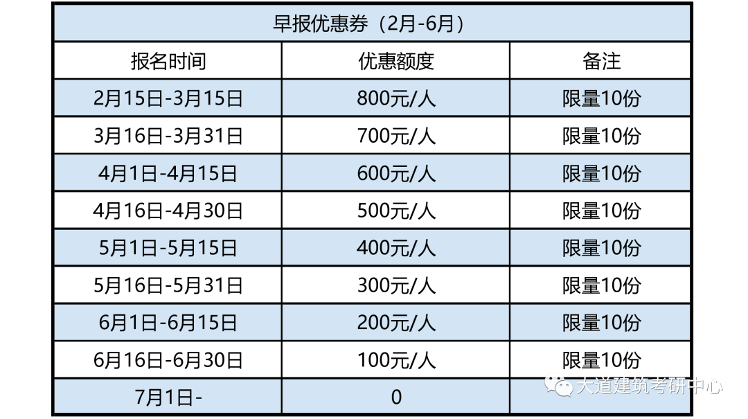
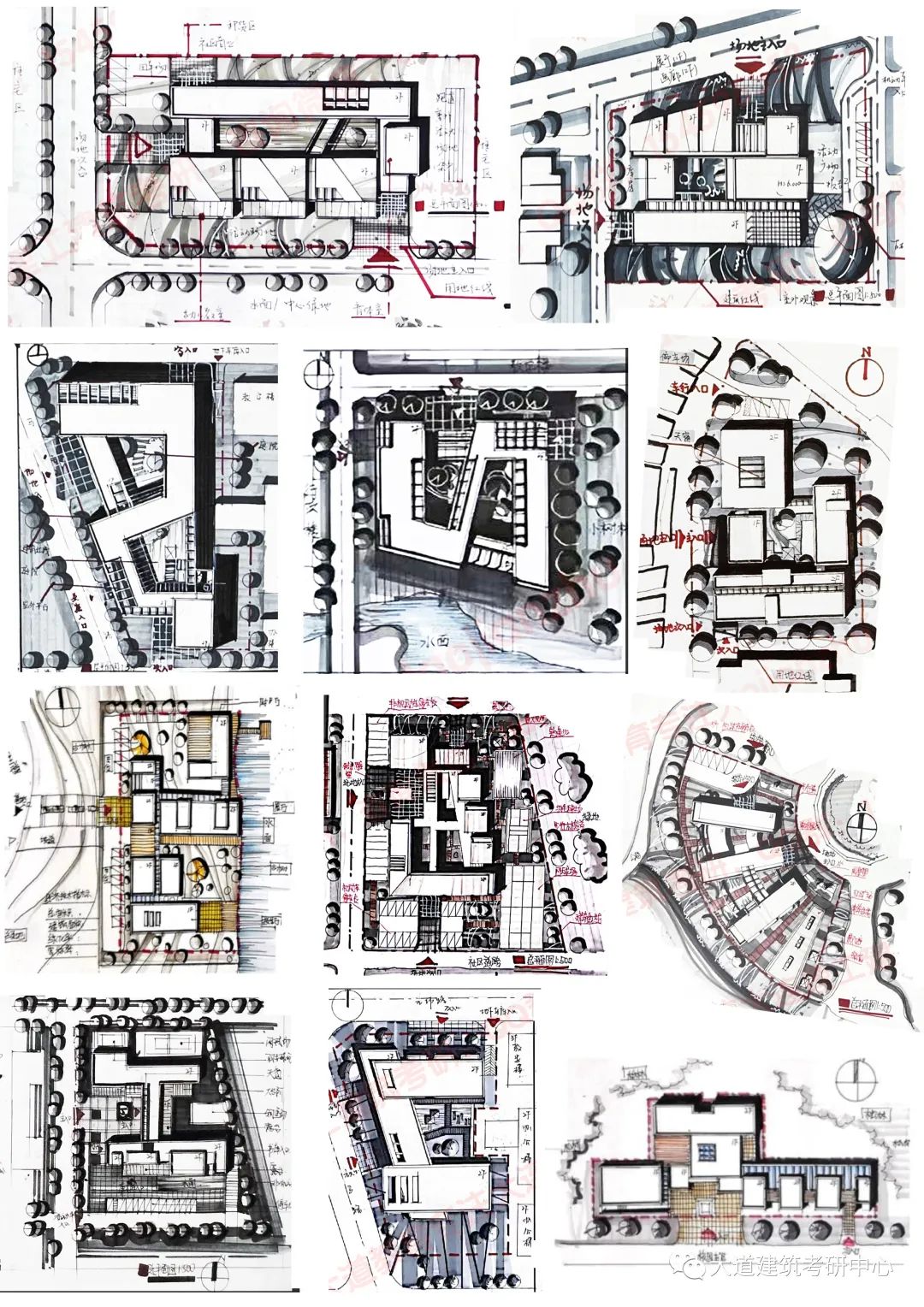
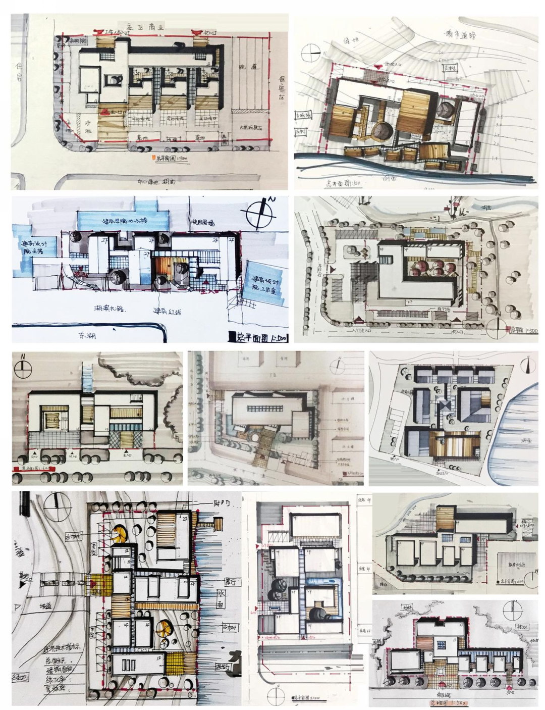
(3) Site Overview: Land Red Line, Road Red Line, Square, Parking Lot, Bicycle Parking Lot, Ancient Trees, Ruins, Rivers (4) Building Identification: Number of Floors, Main Entrance, Secondary Entrance, Logistics Entrance (5) Transportation System Base Main and Secondary Entrance, Vehicle Entrance, Pedestrian Entrance, Depot Entrance, Urban Road and Sidewalk 2 Steps for drawing a general layout plan: (1) Draw the building part (2) Draw the surrounding site (3) Draw the scenery (4) Draw shadows (5) Draw annotations (3) Notes on the general layout plan: 1.
roof garden, roof platform, skylight, etc.
Therefore, a good master plan must handle the organic combination between the building and the base.
North arrow (pay attention to the direction of the north arrow, do not think in a fixed way) The scale of the drawing name is 1:500 or 1:10002.
In the spring, Da Dao Architecture launched a series of basic courses on hand drawing in the “Weekly Practice Plan”, which focuses on introducing a series of learning and painting methods from the practical perspective of beginners in architectural hand drawing to the postgraduate entrance examination.
Regarding hand drawing, whether it is for the architecture postgraduate entrance exam or future work, hand drawing is a basic skill for architects.

Shadow (note that the direction of the shadow should conform to the direction of the north arrow, and the shadow direction of the tree and the building should be unified) 5.
“Map” refers to “building”, and “ground” refers to “square land” and “green land”.

It is necessary to proficiently master the use of markers to draw architectural plans, elevations, sections, renderings, axonometric drawings, and human views.
Choose your preferred concise north arrow drawing method and practice it multiple times to become proficient in drawing.
The floor height (uniformly marked in the upper right or left corner) is represented by 1F, 2F, or 3F for elevation; Special space, such as large space, shall be marked with elevation) 3.
(2) The commonly used scale for the title and scale of the overall map is 1:500, and in rare cases there may be 1:300 or 1:1000, depending on the size of the base.

(1) The north arrow is marked next to the picture, and there are various forms of expression for the north arrow.
The test points of Master Plan Drawing are the overall processing ability of building land (the processing ability of buildings and the environment), which is reflected in the “relationship between the map and the ground” on the drawings.
parapet (the width is calculated as 200 mm; parapet also needs shadow).
shall be distinguished from the expression of floor paving and vegetation of buildings; Mark’s color can be used to distinguish, and at the same time, lead lines can be used to mark 4.
Starting from today, I will accompany you through the entire journey.
Landscape (trees, lakes, and paving) needs special practice in the details of the courtyard
.
02 Theme of this week: Master Plan Drawing 1.